You can pick up a bicycle in one place in the city and return it to another. There are pedal assisted bicycles at your disposal, that give you the opportunity to move quickly, independently and sustainably.
You can pick up a bicycle in one place in the city and return it to another. There are pedal assisted bicycles at your disposal, that give you the opportunity to move quickly, independently and sustainably.
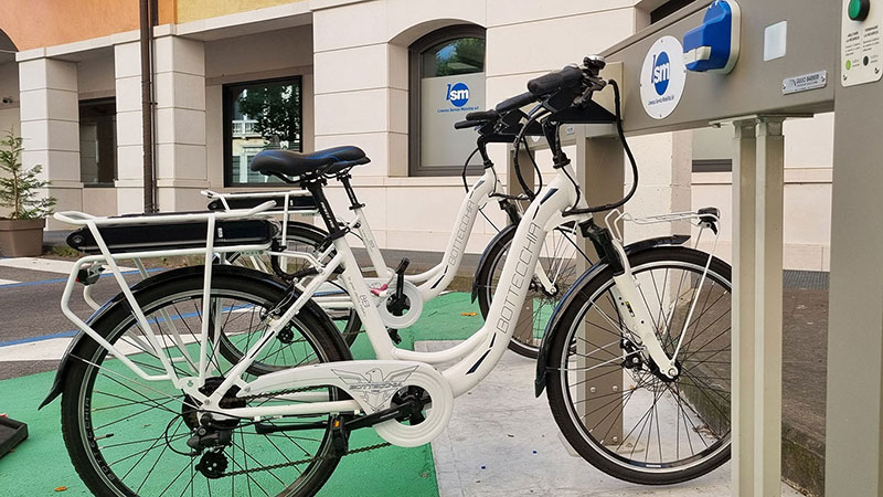
Campo Marzio: e-bike rental + 1 place for charging private e-bikes
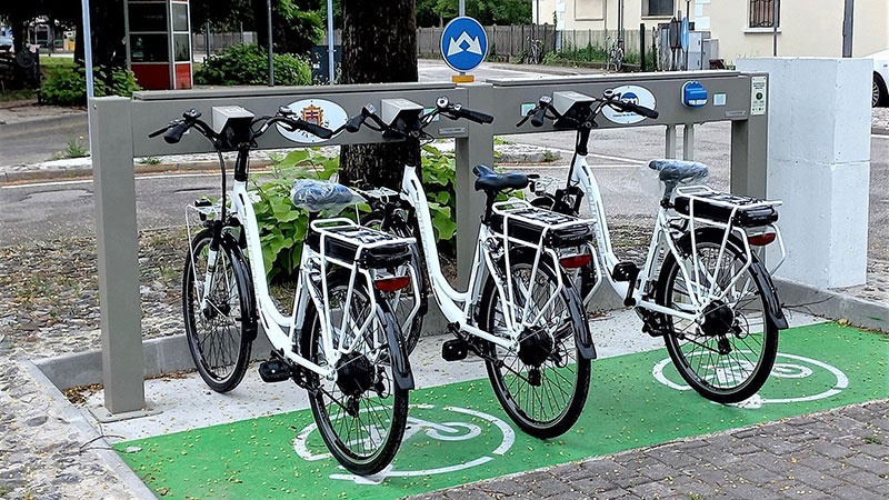
Piazza Libertà, in front of the railway station: e-bike rental + 1 place for charging private e-bikes
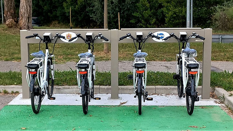
Sports Hall “PalaMicheletto” in via Cartiera Vecchia: e-bike rental
It’s easy!
Rates:
from 0 to 3 hours > € 0.50 every half hour or part thereof (max € 3.00)
from 4 hours to 6 hours > € 1.00 every half hour or part thereof (max € 6.00)
After the 7th hour > € 20.00 up to 24 hours of use
See the term of use
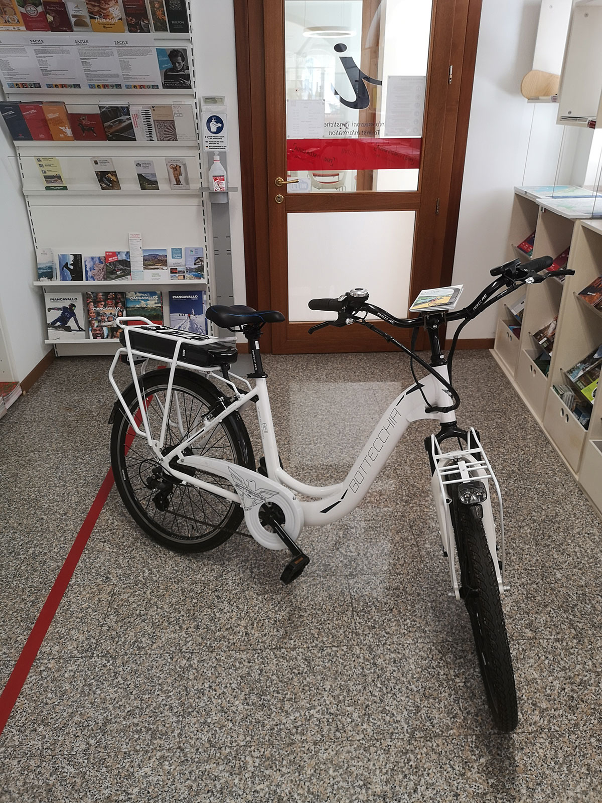
Column for the maintenance of the bicycle
The column for the maintenance of the bicycle is located in Foro Boario and it is equipped with tools, air pump with universal connection and Schuko socket for E-Bike charge.
Discover Sacile and surroundings
On www.visitsacile.it and at the Sacile Tourist Office you can find a cycling map to discover the area by yourself and suggested cycling routes with maps, descriptions, useful information and gpx tracks.

The scheduled appointments in the city to walk along an established route, urban or suburban, guided by a walking leader are the following:
Departures are subject to changes throughout the year, depending on the season.
Participation is free and open!
Info and contact details:
Gruppi di Cammino Sacile, tel. +39 0434 787111, email camminosacile@gmail.com
The antique and attractive town of Sacile, called the ‘Garden of the Serenissima’ during the Republic of Venice, is the westernmost municipality of the Friuli Venezia Giulia region. Sacile can be considered a ‘water town’, since it originated and developed along the banks of one of the most important rivers in Friuli, the Livenza (1).
The route, and the cycling track running along the Paisa Stream (2), an affluent of the Livenza River, are both dedicated to the memory of Denis Zanette (1970-2003), the cycling champion from Sacile who died prematurely. The route is part of the urban development project of the Town of Sacile started at the beginning of 2000, to promote healthy lifestyles and prevention in its different aspects, as indicated by the WHO and the Italian Network of Healthy Cities, of which Sacile is a member.
This route develops in the city of Sacile for about 4 kilometres. It is suitable for families, elderly people, walk groups, nordic walking and more. It is mostly a pedestrian and cycling track and develops on existing trails.
Its starting point is the parking area of Via Carducci, in front of the ‘Forum Due Mori’ (3) social centre, an aggregation and reference place for many inhabitants of Sacile, mostly elderly.
The route then partly runs along the existing ‘Denis Zanette’ pedestrian and cycling track and continues through San Liberale, until it returns to the historical centre through Viale Trieste, Via Cavour, Corte Ragazzoni (4) and Ortazza Park (5).
The itinerary, mostly unwinding in a picturesque natural area, is magical. The remaining part of the route develops in the historical centre and is therefore equally fascinating and interesting.
Along the urban path, it is possible to admire the church of San Liberale (6) and the tower of San Rocco (7), erected between 1470 and 1485 to defend the town from the Turkish invasion. Of the five towers, this is one of the three still standing. The towers were connected to each other by underground tunnels, which originally, together with a wall, defended Sacile.
Another attraction worthy of a visit, and perhaps the most representative building of Sacile’s past is the elegant 16th-century Ragazzoni Palace (8), which bears the name of the last illustrious family of Venetian ship-owners and merchants who lived there.
An itinerary in Sacile’s historical centre is an opportunity to walk among its most ancient boroughs, its monuments of great historical and artistic interest, its natural panoramas created by the river Livenza. This itinerary starts from the train station and will lead visitors through the city’s most characteristic aspects.
From the train station, a short walk along Via G. Lacchin leads to Via Dante and, from there, to Campo Marzio with Palazzo Ettoreo and Palazzo Candiani. On the background, the river Livenza draws one of its most beautiful bends. A pedestrian bridge to the Duomo provides an evocative view on the river, on the old towers from the Commune period, on abandoned electrical stations and on the buildings in Piazza del Popolo. The pedestrian bridge leads directly to Piazza Duomo, almost a small Venetian square, located on one of the two islands created by the river, and once called “City”. Piazza Duomo is home to Duomo di San Nicolò, Palazzo Ovio Gobbi, Palazzo Carli with Centro Studi Biblici and Galleria Pino Casarini, and Chiesetta della Pietà. Historically, this is the most ancient part of the city, which was the heart of trade, while Piazza del Popolo was a residential area for the noble.
From Piazza Duomo, two ancient “contrada” branch out: Via Pujati (Contrada Ruga) and Via Gasparotto (Contrada Montalbano).
They host houses with porticoes and ample columned ground floors, in accordance with the classic structure of workshops in the Commune period.
The two Contradas lead to Foro Boario (Pra’ Castelvecchio), where precious glimpses of the ancient defence system of the city can be caught: remains of strong walls and a perfectly preserved round tower.
From Parco di Pra’ Castelvecchio, Via Mazzini leads to Vicolo del Livenza: a small pedestrian route ending in wooden bridge which leads to Parco dell’Ortazza.
After a pause in the green scenery, the Courtyard of Palazzo Ragazzoni can be reached: its 12 stucco statues on the two floors along the internal façade of the Palazzo anticipate the rich artistic and historical heritage on its inside
Visiting the Palazzo means admiring the frescoes painted by F. Montemezzano on the noble floor, and the stucco decorations of the Cappella Gentilizia. Outside the Palazzo, along Via Cavour it is possible to gaze at the elegant 17th and 18th-century buildings, like Palazzo Granzotto and Palazzo Sartori, which is close to the round tower of S. Rocco. Opposite the tower, a small road leads to Ponte delle Prigioni, a bridge named after the fact that it ends in Piazzetta Manin, which used to host the ancient prisons. The bridge offers a unique sight on the branching of the river Livenza at the entrance of the city. Piazzetta Manin is close to Piazza del Popolo, the ancient “Portus Sacili”, a dock for merchant boats. Also known as Piazza del Mercato, for many centuries it has been the heart of “Sagra dei Osei”, an historic exhibition which takes place every year on the first Sunday after August 15th.
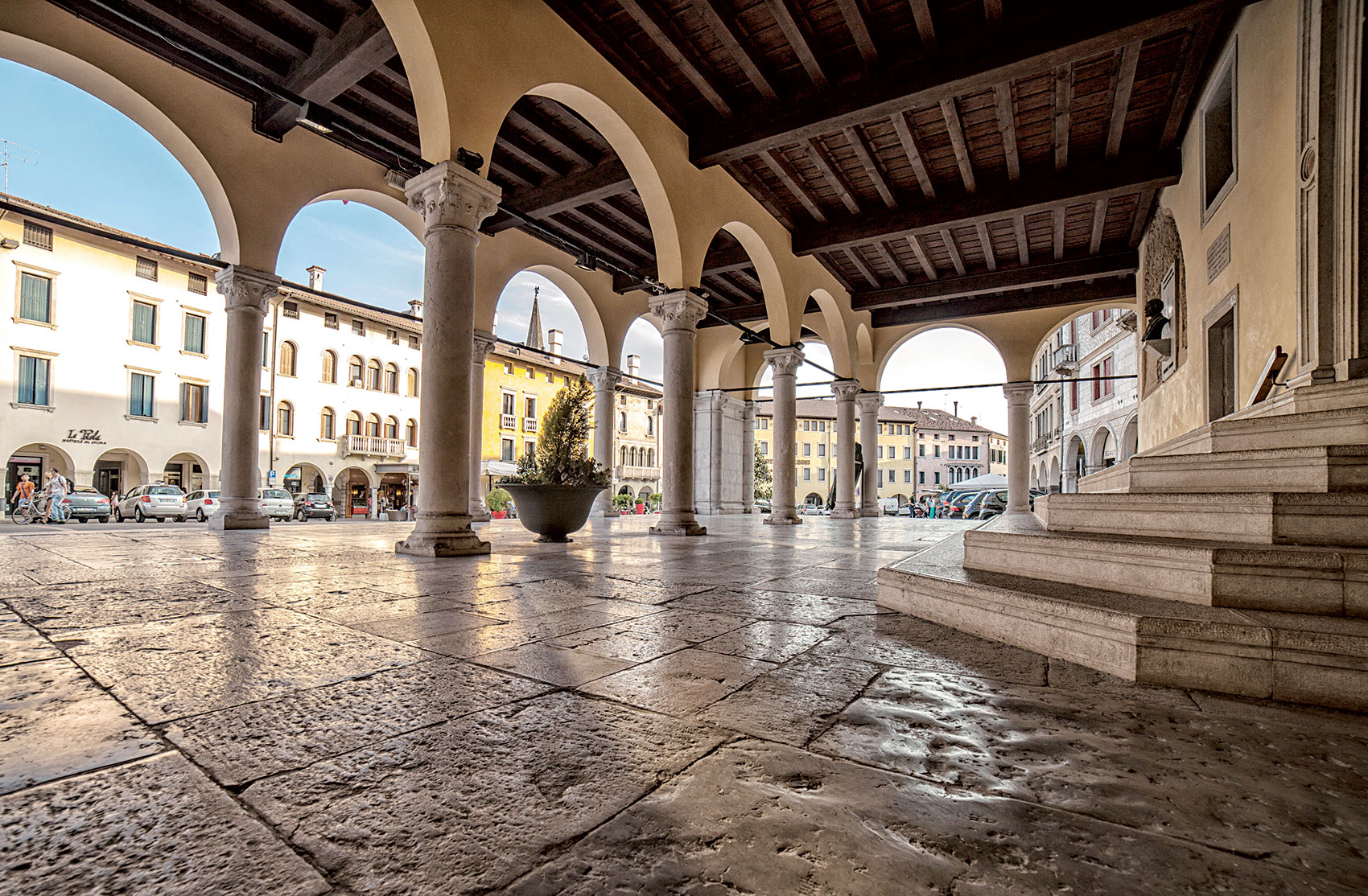
The view spans on the piazza, with its skyline made of warehouse-buildings, three of which are of particular interest: Palazzo Fabio-De Zanghis, Palazzo Loschi and Palazzo Pianca. To the right, the 14th-century Palazzo Comunale stands like an ample stage. The itinerary goes on to Ponte della Vittoria, a bridge offering a marvellous panorama on the mountains and on another branch of the river Livenza with Canale della Pietà and the apse of the Duomo. To the right, after the native house of the painter Luigi Nono (19th century), the curve-shaped Via Garibaldi hosts 17th and 18th-century buildings with porticoes and significant ancient architectural elements. The most interesting buildings in this road are Palazzo De Casagrande, Palazzo Prata and Palazzo Doro.
Halfway through the road, to the right, Ospitale di San Gregorio and Chiesa di San Gregorio, with its elegant bell tower, witness the historical role of this part of the city: this is the ancient Borgo San Gregorio, a borough which used to be at the entrance of the city in the Middle Ages. At the end of Via Garibaldi, after Piazza IV Novembre, Via XXV Aprile leads to the 16th-century building Palazzo Bellavitis. By turning left in the small piazza, Viale Lacchin leads back to the train station, the starting point of this itinerary aimed at discovering the city of Sacile.
A few ideas to visit the city of Sacile and its surroundings on a canoe.
Sailing on the river Livenza on a canoe means moving across the territory, reliving the ancient communication route to Venice, where goods and people travelled in both directions, when the always active mills of Sacile used the almost constant water flow of the river to attract goods to be processed and the wood travelling to the Arsenale in Venice from the forest of Cansiglio.
The canoe allows to see the city of Sacile and its surroundings with new eyes, discovering a lively, unexpected natural environment which is unknown to most people. This exciting trip combines art, history and nature, reaching the territories of the nearby towns of Brugnera, Fontanafredda, Caneva and Polcenigo.
A canoe is an open, versatile watercraft, with two or more seats, propelled by a single-bladed paddle, similar to the boats used by Northern American indigenous tribes. Canoes are used for tourism, fishing, sports or exploring.
A canoe does not create pollution, waves or damages. It flows silently and does not inconvenience the fauna living above and under the water.
A canoe is perfect not only for sports competitions, but also as a sport for everybody, offering intense emotions and lots of fun both to the elder and the young.
The river Livenza can also be sailed on kayaks, which require specific technical skills according to the difficulty of the trail, or on a Raft (Rafting), for a funny tour in company.
Idea
Itinerary
River itinerary
Average time
Difficulty
Sacile: a glimpse from water
Sacile city centre – panoramas of the city and the river
1 km
40 minutes
easy
The tranquil waters of the river Livenza
Fontanafredda (Chiesetta S. Antonio A.) – Sacile city centre
5 km
1 hour
easy
Among the meanders of the river Livenza
Sacile city centre – Cavolano
6,5 km
1 hour
medium – difficult passages
The countryside from the river Livenza
Sacile city centre – Caneva (Fiaschetti hamlet)
Possible with return to Sacile (average time 3.5 hours)
6 km
2 hours
easy
From the city to Villa Varda – on the traces of the noble
Sacile city centre – Villa Varda, Brugnera
15 km
2,5 / 3 hours
medium – difficult passages
Sacile: a glimpse from water
Itinerary: Sacile city centre – panoramas of the city and the river
River itinerary: 1 km
Average time: 40 minutes
Difficulty: easy
The tranquil waters of the river Livenza
Itinerary: Fontanafredda (Chiesetta S. Antonio A.) – Sacile city centre
River itinerary: 5 km
Average time: 1 hour
Difficulty: easy
Among the meanders of the river Livenza
Itinerary: Sacile city centre – Cavolano
River itinerary: 6,5 km
Average time: 1 hour
Difficulty: medium – difficult passages
The countryside from the river Livenza
Itinerary: Sacile city centre – Caneva (Fiaschetti hamlet). Possible with return to Sacile (average time 3.5 hours)
River itinerary: 6 km
Average time: 2 hour
Difficulty: easy
From the city to Villa Varda – on the traces of the noble
Itinerary: Sacile city centre – Villa Varda, Brugnera
River itinerary: 15 km
Average time: 2,5 / 3 hours
Difficulty: medium – difficult passages
A holiday in Sacile can turn into an opportunity to live a genuine experience, in silent contact with nature in the deep green of the vegetation mirroring in the waters of Livenza.
Born many centuries ago, leisure fishing is an art which has evolved quickly in terms of philosophy, techniques and tools. Originally aimed at survival, today it is always more and more triggered by the desire to plunge in the environment and be part of it, of living in nature by confronting it.
In this regard, the river Livenza has much to offer: its waters are extremely varied, with river bottoms ranging from rocks, to lush vegetation and mud. Sacile also hosts a significant quantity of fish: graylings, various species of trout, chubs, carps, common rudds and eels. Fishing is a fruitful activity in Sacile.
Fishing is regulated by a specific regional body, Ente Tutela Pesca del FVG, and is allowed starting from 7.00 a.m. of the last Sunday of March until the last Sunday of September. Exceptionally, at the dead lake in Cavolano, fishing is allowed all year round, even though limited to specific species. In the city centre, part of the river is a “no kill zone”, where fishing is allowed only with artificial tools.
The activity is subject to an authorization which can be daily, weekly, monthly or yearly.
For information on opening hours and mandatory authorizations/permits:
Address: Via S. Quirino, 9 – Pordenone
Tel: 0434 550588
Website: http://www.etpi.fvg.it/
Hours: Monday, Tuesday, Thursday 9-12
Address: Via Mazzini, 2 – Palazzo Badini
Tel: +39 0434 520381
The area features particularly beautiful landscapes with river environment characterized by an exceptionally lush and varied flora and by a fauna which has almost disappeared elsewhere.
From Sacile, or in Sacile, many itineraries can be planned: southwards in the countryside with its historical remains, or northwards at the foot of the mountains, with the springs of the river Livenza, boroughs and castles, and the pile dwellings in Palù di Livenza.
The most skilled riders can venture out to the forest of Cansiglio and Friulian Dolomites to enjoy breath-taking panoramas, ancient paths (sometimes paved), sweet slopes and arduous traits, cottages, pastures and woods. These areas, with their natural attractions, offer panoramic views on the plain below, conveying a magic serenity. On clear days, the panorama stretches to the sea.
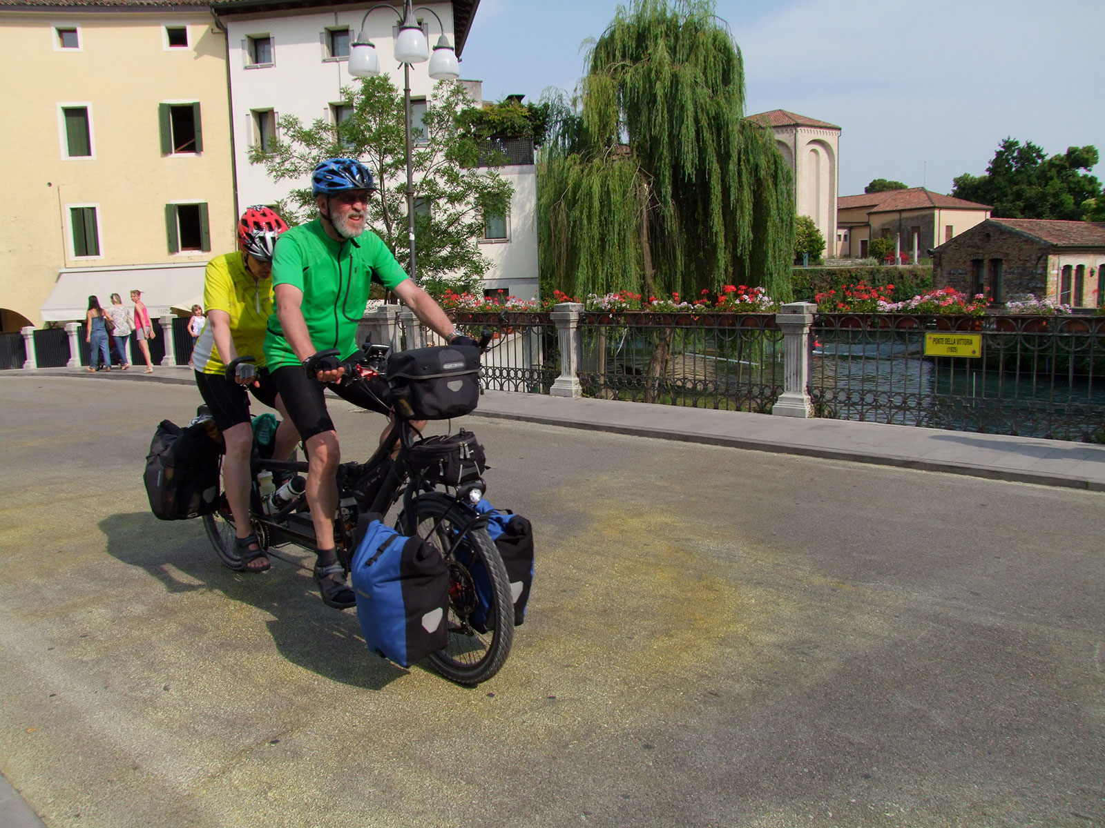
Historically, Sacile is an important meeting point: a crossroads between the mountains and the sea, between Friuli and Veneto. It is the gateway to the Cansiglio and Piancavallo mountains to the north, the starting point for descending along the Livenza river to the Adriatic Sea to the south, the main point of passage between the Friulian plain to the east and the Marca Trevigiana to the west. Sacile is also a node in the Friuli Venezia Giulia cycling network, through which two cycle paths and the national FIAB AIDA route pass. Other routes, which are very popular with cyclists, branch off from these axes in all directions, making the city a popular base for two-wheelers.
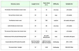
These 8 itineraries allow you to discover the territory in every direction; map, descriptions, useful information and gpx track for each are available for free!
Itineraries for cycle tourism
This tour on two wheels is perfect for anyone wishing to discover Sacile through the sweetness of its river
and countryside landscape, the harmonious lines of the Venetian architecture in the city centre and the
historic remains along the way. It is therefore a very easy route, even for those who do not often cycle and
it allows to reach villages and hamlets of Sacile.
Informazioni sul percorso
Mappa
Traccia gpx (file zip)
The Lower Pordenone area is characterised by two important rivers: the Livenza and its main tributary, the
Meduna. Enclosed within mighty embankments, the rivers are not always visible from the path, but
important towns have emerged along the banks and have shaped the history of this area: Sacile, Brugnera,
San Cassiano, Portobuffolè, Prata di Pordenone.
Informazioni sul percorso
Mappa
Traccia gpx (file zip)
The Meschio River, which emerges from a couple of small lakes just above Vittorio Veneto, is a tributary of
the Livenza River, where it flows into just below Sacile. There is a natural and historical link between these
two cities: the river and the fact that they belong to the same diocese. A visit to this historical town is
therefore a must, not least because it is still the main point of reference for the whole communities on the
Livenza side.
Informazioni sul percorso
Mappa
Traccia gpx (file zip)
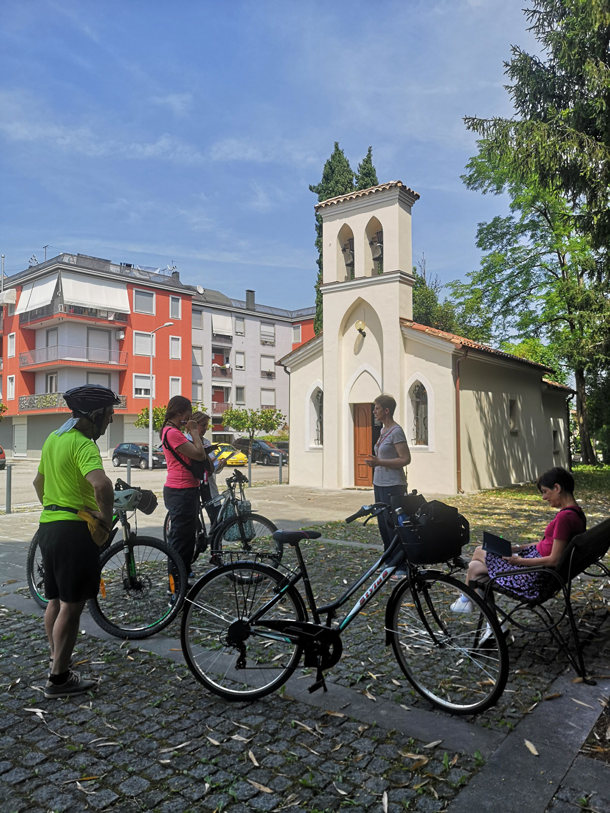
This route connects Sacile to Pordenone and vice versa, avoiding the busy regional roads. This circular route
is not only a tourist itinerary, but also an intercity mobility route, as the two towns are only 12 km apart as
the crow flies. They are also linked by the railway and all frequent regional trains allow bicycles to be carried.
It is therefore a very easy route, even for those who do not often cycle, and allows you to visit the two
beautiful cities in complete comfort, while also being able to count on intermodal train+bike services to skip
a stretch of road.
Informazioni sul percorso
Mappa
Traccia gpx (file zip)
Sacile’s history, culture and even its name are linked to the Livenza river, which flows through the city and
embraces the historic centre, branching off and coming together to form two islands. It owes much of its
importance and historical, political and economic status to this treasured waterway. The Livenza River
originates not far from here and its three spectacular springs (Molinetto, Santissima and Gorgazzo) have held
a mystical and supernatural aura since ancient times, both because the water rises pure and very abundant
from underground, and because the exact point where it originates and the route it takes to reach the surface
are not yet known.
Informazioni sul percorso
Mappa
Traccia gpx (file zip)
The Ciclovia Pedemontana FVG 3 is an important cycling route in Friuli Venezia Giulia. It is 185 km long and
runs from Gorizia to Caneva through the Friulian foothills. It has a unique characteristic: it crosses places
characterised by the best Friulian wines and various food and wine products that have become part of the
Slow Food movement. It is a true ‘Taste Route’!
Informazioni sul percorso
Mappa
Traccia gpx (file zip)
Venezia delle Nevi is the road from Dardago up the valley of the Artugna stream to Piancavallo.
Built in the 1960s, cleaned and restored in 2019 by paving the section that remained unpaved, it is now a
beautiful MTB route, wide and rideable on an E-MTB for those who have not had a lot of training.
Informazioni sul percorso
Mappa
Traccia gpx (file zip)
The ascent to Cansiglio from Sacile is one of the classic Sunday excursions for MTB, E-Bike and road bike
riders. You’ll never be alone on the road, even on the most unlikely of days for cycling!
It is a steady, shady climb, not very long, with few climbs. The road is not particularly busy, even during tourist
periods and at weekends, it is not very wide and there are several bends and hairpins; be careful, especially
downhill!
Informazioni sul percorso
Mappa
Traccia gpx (file zip)